Sprint Scotland 2024 (and the Collydean map)
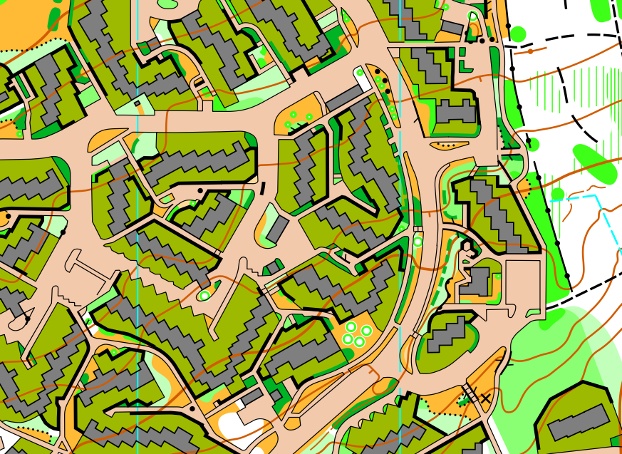
Hello everyone! I'm catching up on articles for my website and so this is a throwback to May and Sprint Scotland. I have written my WOC write-ups (about 20,000 words in total!) but I'm not allowed to publish them until at least the IOF report has been written, which has a deadline of Christmas. I'm also aiming to write one about doing the Polmaise map because the event is this Saturday!
Back in September 2023 Graham Gristwood and I were scouring OS maps looking for the best remaining unmapped sprint areas in central Scotland, and Glenrothes stood out as having the largest areas of really good terrain. Between 1945 and 1966, five towns in Scotland were chosen to be massively expanded into "new towns": Livingston, Cumbernauld, East Kilbride, Irvine and Glenrothes. Livingston and Cumbernauld are top class orienteering areas, so it was a surprise that none of Glenrothes had been mapped yet.
Glenrothes is split neatly into housing estates, most of which have their own primary school. The south-west was the most obviously good area, with five big estates of high-granularity terrain: Macedonia, Tanshall, Caskieberran, Rimbleton and South Parks. However, they are all quite rectangular; with most blocks and roads at right angles. There was an area in the north that caught my eye - Collydean, Pitcoudie and Cadham, where the buildings and roads are really irregular, unusual shapes. A quick look on streetview confirmed it was good, and for good measure it had loads of bushy areas where you would normally expect grass in a housing estate.
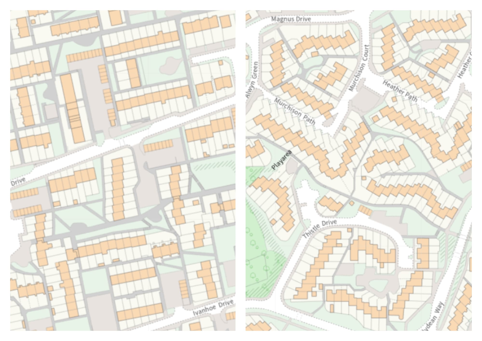
The primary schools seemed like they would be ideal arenas (ha ha, more on that later), so I sent out requests through the School Lets team at Fife Council. Eventually, we had provisional green lights back from a few of them, including Caskieberran, but neither Collydean or Pitcoudie Primary yet. We decided GG would map the southern area, which eventually settled on Caskieberran and Tanshall, so only 40% of the original, and it still filled an A4 1:4,000 map. I'd do the northern area, which split itself into four - Collydean East and West, Pitcoudie and Cadham. Collydean looked the best area, and with the primary school in the middle that was the preferred choice. There was a question of whether crossing the road to/from Cadham was ok too, so I began mapping Collydean and Pitcoudie.
As usual, I started from the OS MasterMap, and LiDAR (point cloud), from which I use the contours, the 'classify vegetation' map and occasionally the hill shading.
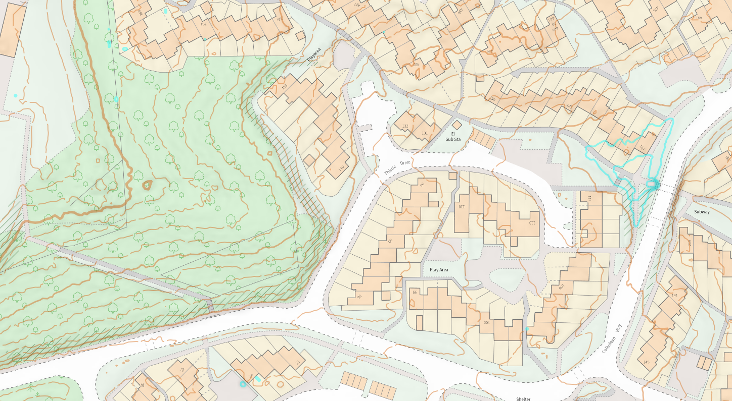
I soon realised that it would take a bit longer than 'normal', due to the defining feature of this mapping project - the bushes! Some areas are scattered and passable, some are completely solid and physically uncrossable, and some, the most difficult kind to map, are mostly solid but with one or two gaps.
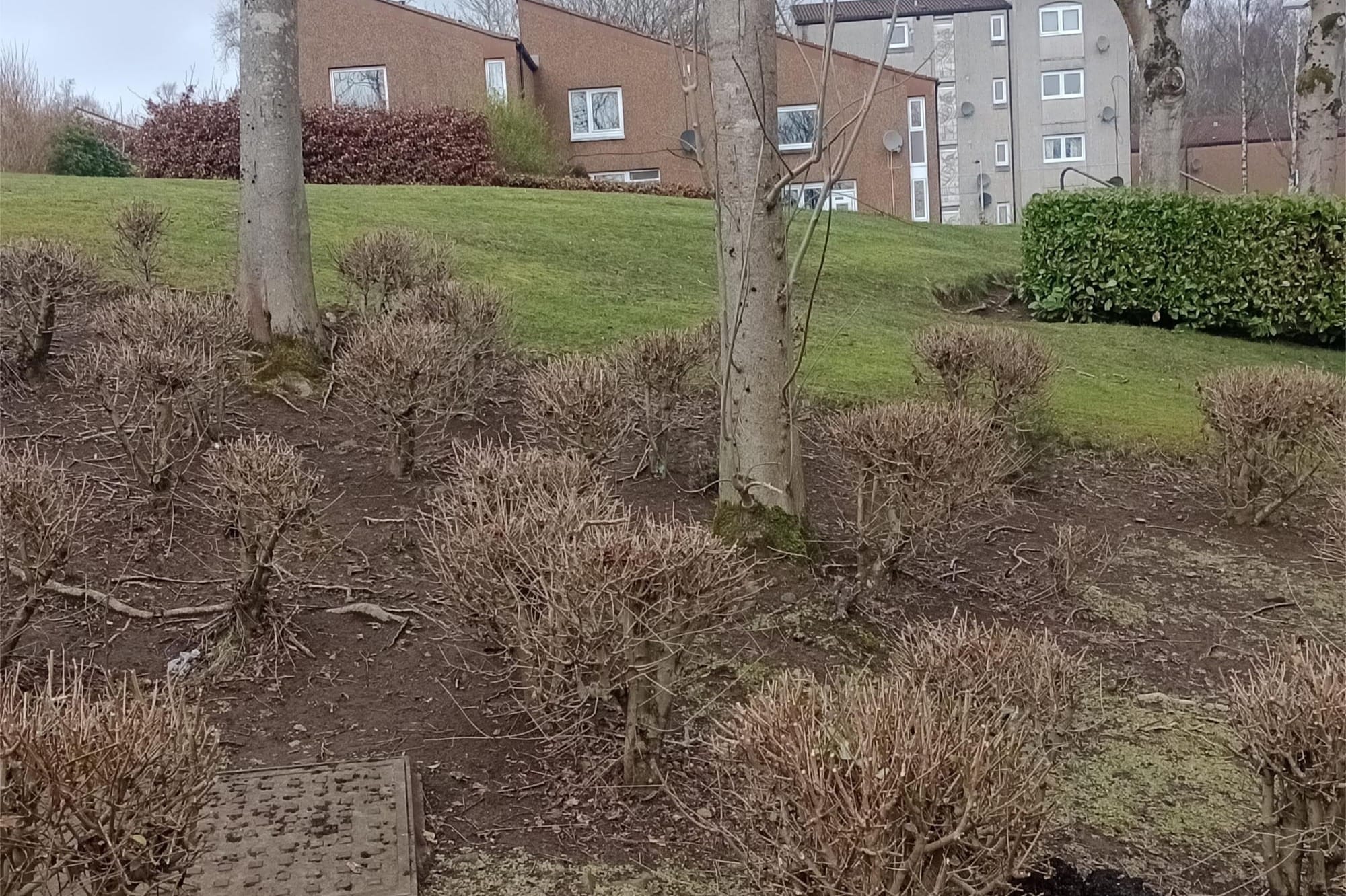
Firstly the passable ones: upon first glance, you might think these are the definition of the scattered bushes symbol, so why does that symbol not appear anywhere on the final map? The answer is that most of the areas are small, much smaller than ISSprOM says is the minimum amount of 'scattered bushes' you need to be readable (6.25mm2 / 100m 2). The bushes are usually knee-hip high, so what about vegetation slow running (green stripes)? Well, the minimum area for that is just defined as "2 lines", but the smaller areas don't meet that. So, I felt the best option was a mix of light green (min. 1mm2 / 16m2) and medium green (min. 0.5mm2 / 8m2). This has to extend to the bigger areas too because you want consistency across the map - if a certain type of bushes are mapped as, say, medium green in one place, the same type of bushes in another place should also be medium green.
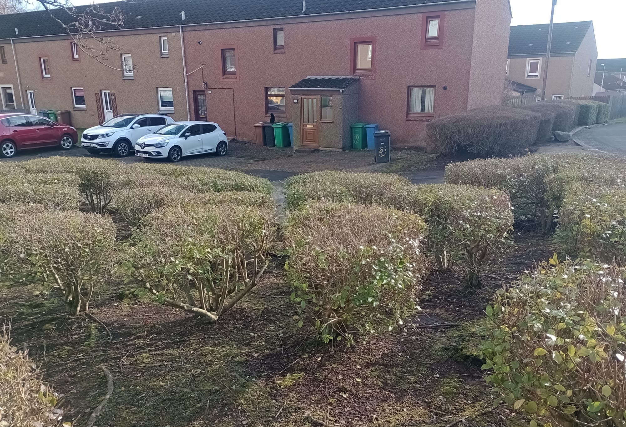
Next, the uncrossable, or mostly uncrossable ones. 410 vs 411 decisions can be a controversial topic. 410 is vegetation (fight) - barely passable. 411 is uncrossable vegetation (forbidden to cross). If you cross 411 you get disqualified. From numerous conversations about this over the last few years, athletes don't like the use of 410 in places where crossing it provides the shortest route. This is because the single most important information we want from a sprint map is "can I get through?" and we base our route choices on this. 410 therefore is an unwelcome dilemma - you have no way of knowing whether you will be able to get through or not. However, when using 411, you better make sure that the hedges/bushes are either physically uncrossable, or if there are gaps, that you close them with tape. Of course, you can map a gap in a 411 hedge, but this only works if there is a single well-defined gap, partly because the gap has to be 1mm / 4m long in a linear hedge.
So, the result was that for a mostly uncrossable area with one or two small gaps, I decided we would need to tape them and marked them with little purple lines on the map (which obviously would be deleted from the final version). The same applies to an uncrossable fence which has small broken sections - you either map the gaps, or tape the gaps shut.
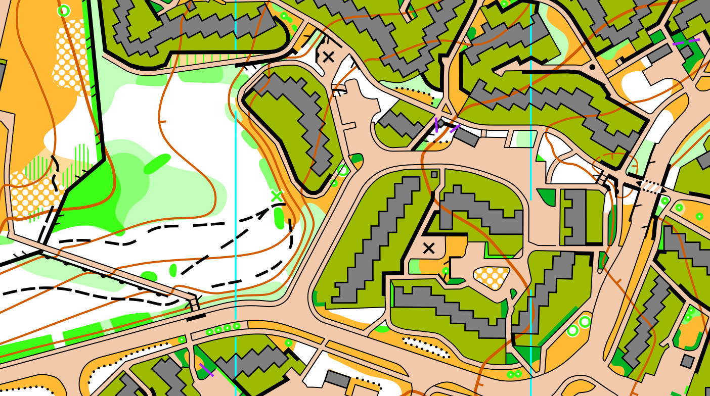
Outside of that, the mapping challenges were all quite familiar: enlarging narrow alleys, positioning contours not to obscure things, deciding which steps should be mapped (my philosophy is to map them if they slow you down, which I think begins at about 4 or 5 steps in a sufficiently steep staircase. Fewer, or shallower, and they don't slow you down much). With all the bushes, the map was quite detailed, verging on cluttered, so I made the decision not to map the pavements of quiet roads where they were parallel to the edge of the road, only where the deviated.
Glenrothes is interesting in that it has many patches of woodland between the housing estates, especially in the north. Including sections of forest in a sprint can be another controversial subject. Generally it is considered acceptable to include sections of runnable forest, but not to have technically difficult forest orienteering.
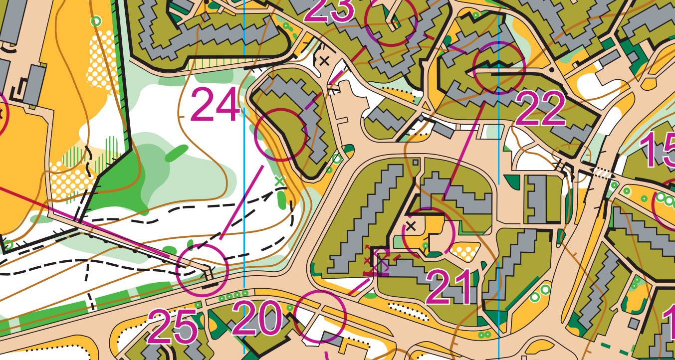
Once the maps were done we began a very stressful few weeks of pulling the event together. Frank and Joe had agreed to plan, though all three of us were very busy with WOC too. I don't want to revisit too much of the stress but basically the planning and controlling process was condensed into about two or three weeks, which made our controllers and IOF adviser rather nervous, understandably. Sprint Scotland prides itself on being high quality, with attention paid to all the little details so that the risks of unfairness, complaints or disqualifications are minimised on the day. Since doing that was basically also my WOC job, I very much wanted to avoid any mistakes creeping through.
I'd been in touch with the School Lets team at Fife Council since the start of December 2023, and now had booking confirmations for the two arenas. However, with two weeks until the race, I got an email to say the headteachers were nervous about the events, and after a couple of phone calls it transpired they were very nervous indeed, hadn't really been told what was happening, and now didn't really want it to happen. Not ideal when you're trying to put on world ranking events and GB test races. In the end I had to go to Glenrothes and meet them in-person on the next working day to try and negotiate us still being able to go ahead. We got to a compromise, just with very little indoor space. The IT team were not best pleased with this as they were wanting to test some WOC things, but they made it work.
All that meant I spent about 100 hours on it in the 12 days before the races, and I'm sure Frank and Joe put in some huge hours too. On the day though we were all incredibly relieved to see the courses go down well with the athletes. Frank and Joe had done a sterling job - a good level of tricky route choices and execution - and we had no complaints.
If you came to the races, I hope you enjoyed them!
