Craigmillar

Craigmillar Castle Park is an inner-city area with a mix of woodland and parkland which INT use for local and newcomer's events and EUOC often use for Fight with the Night. If it existed out in the countryside somewhere, it would probably get mapped at forest spec, but because it is adjacent to some decent housing estate sprint terrain, and isn't particularly big, it gets mapped at sprint spec. When INT asked me to make a new map of it I was very excited - it's a lot of fun making a forest sprint map and it's an area I've run on many times.
The old map (here) was the old 1:5000 sprint spec, and to be honest even when we were running on it 6-7 years ago we knew the map was a little weird in places. It is good in that it's pretty easy to read, but you just knew there was more going on in the vegetation and you could sometimes get stuck in a big pile of unexpected brambles.
The LiDAR and OS base were much the same as for other maps so I won't talk about that again. 1:4000 and 2.5m contours gives you the opportunity to map in a lot of detail and include some very small features if you want to, whilst still not breaking the spec. However, I still wanted to make a nice readable map so I was trying to keep my forest generalisation brain switched on for some areas of vegetation.

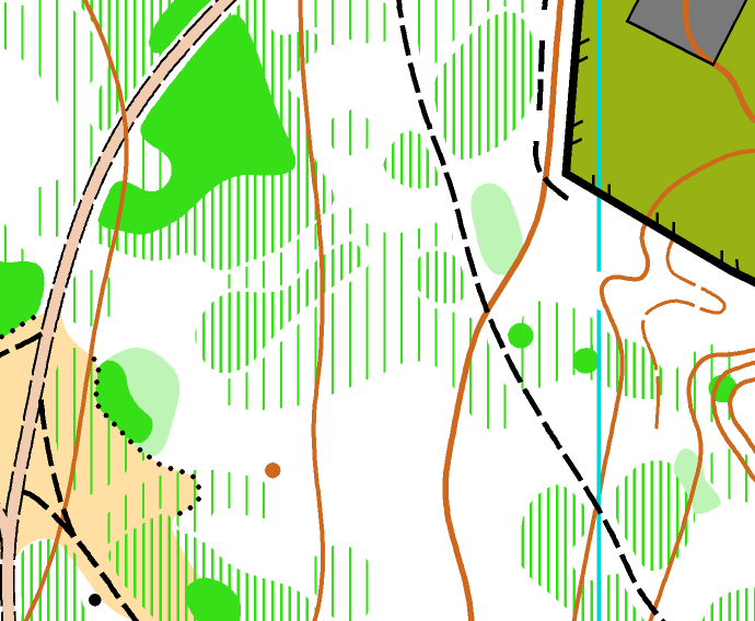
The brambles varied a lot; some patches were completely impenetrable, so I even occasionally used solid green 'fight' for them. Often they were clumped into denser areas with places you could run between them, so I thought I'd show that as best I could, while trying to avoid being silly with tiny areas.

I left tiny gaps between the wider green stripes and the narrower one, which I think helps you to see the intended boundary more clearly.
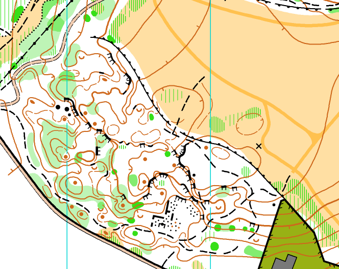
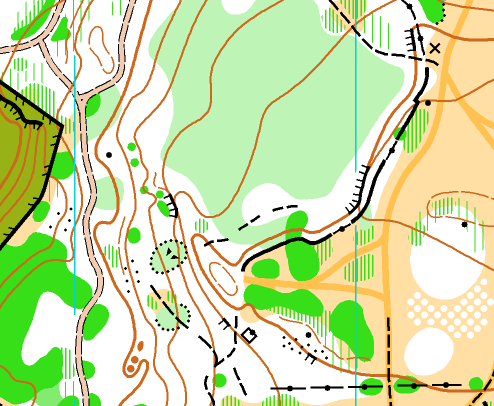
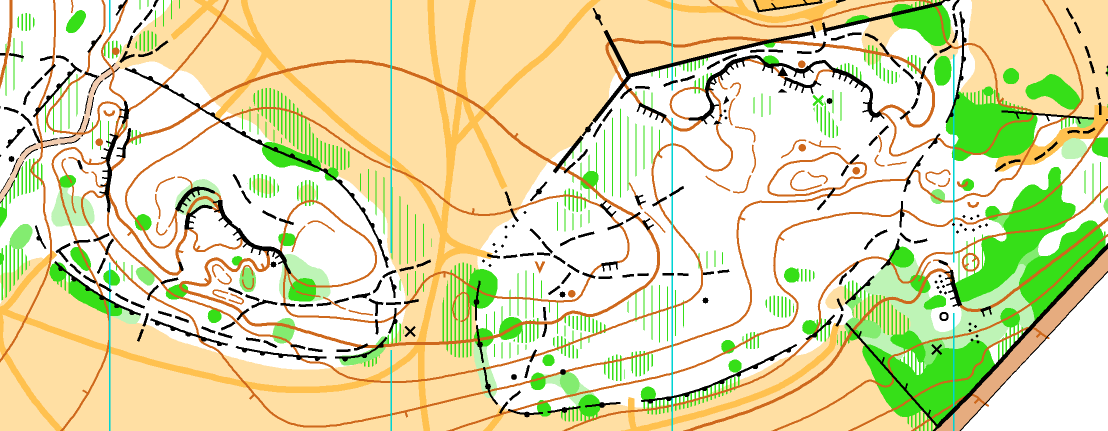
By far the nicest sections were the detailed white areas, which should be excellent fun at a FwtN. The extract of the best section is at the top, and these are two of the other really nice bits:

It is a pleasure to map intricate contours with the sprint specification. 2.5m contours, with a few form lines, and all being nice and thin, give you the ability to pretty much show the ground exactly as you want it.
All of the above I wrote before INT used the map for the first time this weekend. To be honest, I was a little dismayed when I saw the final details said it was being used at 1:6000, rather than 1:4000! All the symbols would be super thin and the point features would be super small. The only reason I can think of for doing it would be so that they could print it at A4 rather than A3. Anyway, it means that it would be a stern test of the readability!
The map is on INT's Routegadget here (note the map they've used for Routegadget still says 1:4000 on it). The courses are interesting to see - they've used some features that I would never have expected to be used for control sites. Particularly things like #1 on Blue - the edge of a patch of brambles. Now this is very picky but the description for it was 'vegetation boundary' and to use that there should really be a distinct veg boundary symbol on the map. Arguably it could pass as a thicket, but the point is that while I was mapping I would never have expected a control to be put on what I thought was quite a vague feature. On the other hand, I suppose it is a compliment to the map that the planner thought bits of vegetation were mapped accurately enough to put controls on!
I'm very much looking forward to running a Fight with the Night there in a couple weeks' time!
