Going international
Back in the summer of 2023, I was chatting to my friend Lucia about mapping, and she mentioned that her clubmate in Snättringe SK, Joel, did a lot of mapping and I should talk to him. So, I got in touch and it turned out he was getting more requests than he could do because he had recently started a new (non-mapping) job. Since I was starting to work on WOC, I couldn't commit to going to Sweden to do any mapping for nearly a year, but in September this year, we finally arranged a time to come. Big thanks to Joel for making it happen!
Initially, it was two urban maps: a small town called Borrby and a section of Simrishamn, a small city.
Borrby
The first thing I had to come to terms with was the lack of an OS mastermap, the lovely accurate base map that makes sprint mapping in the UK so easy. So, all I had was the LiDAR and satellite photos.
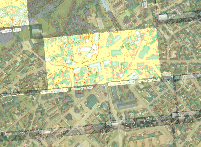
However, one thing on my side was that they are not short of land in Sweden, and so they tend to build nice wide streets, compared to the UK where buildings and roads are often crammed together at ISSprOM non-compliant distances. The lack of such an accurate base map does also give an opportunity for neatness, in a way. I would say a lot, perhaps a majority, of ISSprOM rule-breaking in the UK occurs because the base map has been blindly copied, and even I am not always immune to it. This time though I had pretty free rein to draw the lines where I wanted, at the expense of accuracy sure, but in favour of clarity.
Simrishamn
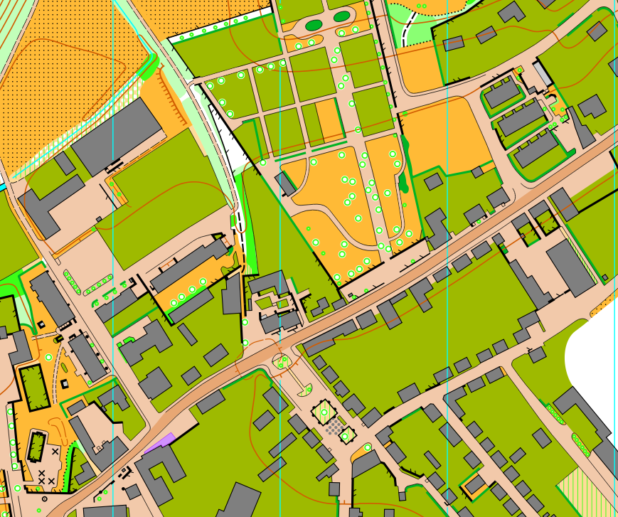
Next up was Simrishamn, where Joel, another mapper and I were splitting the full map between us. Happily, we had a half-decent base map for this one. Not as good as OS, but better than nothing. This sort of base map exists for maybe 10% of local councils in Sweden. Perhaps some are better than others.
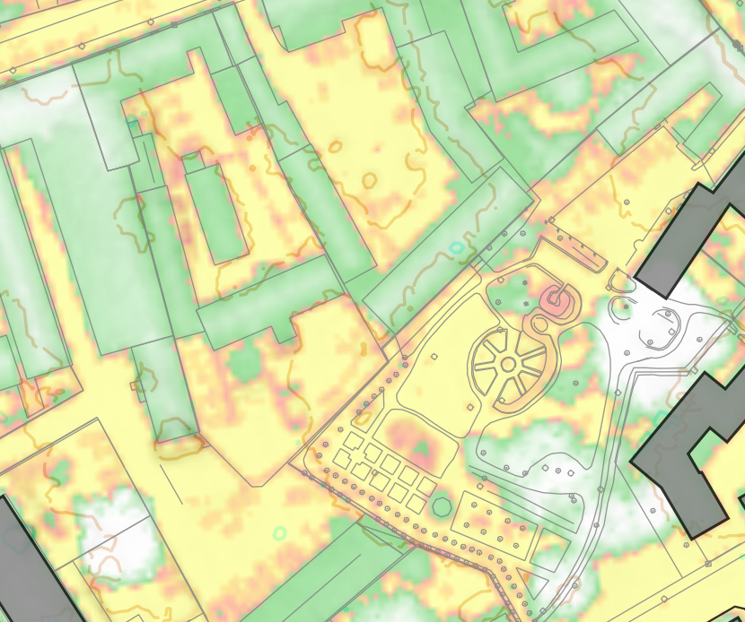
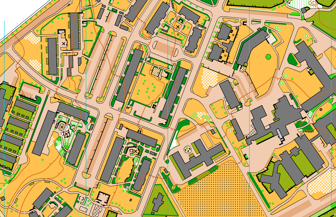
Compared to Borrby, the mapping was a bit trickier because there were quite a few big apartment blocks with communal green space in the middle, which were packed with hedges, paths, bits of vegetation and playground equipment. To add to the difficulties, it often turned out that the base map didn't match what I found on the ground in some of these.
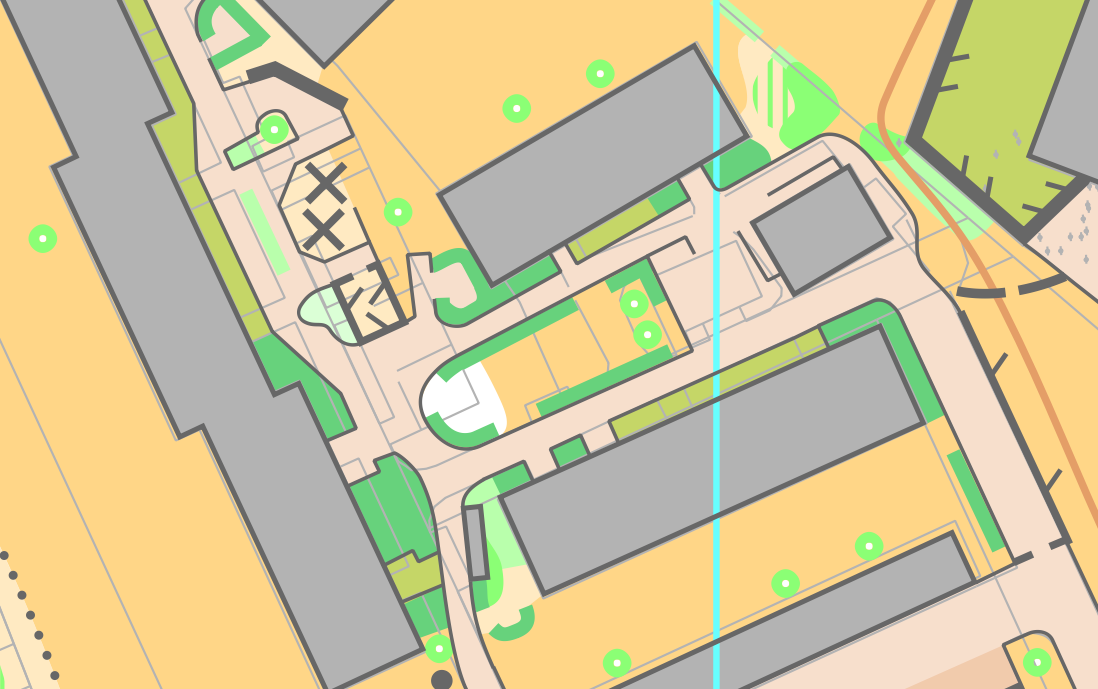
Joel and I decided that we wanted to do darker brown for car parks, which I quite like and you can see on the extract below. Also, if you look closely at the scattered trees and areas with obstacles, I hope you think they look clean...
Timsfors
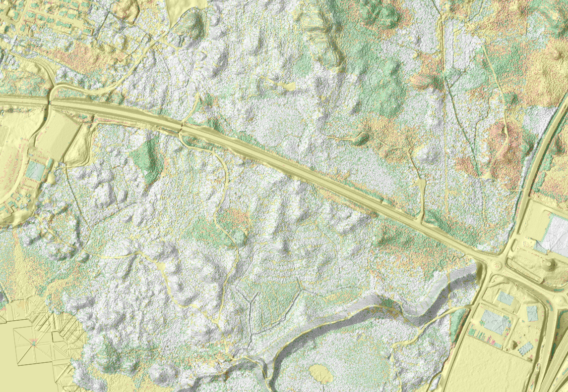
As well as the two urban maps, Joel had a big forest map that I could help out on if I had spare time, and in the end I had plenty; a good 5 or 6 days of fieldwork to sink into a Swedish forest mapping apprenticeship. The base was LiDAR as usual:
We also had an old (about 15 years old) map to help. We marked 'old boulders' and 'old pits' etc with purple symbols which we'd then go and visit to check if they were still there and in the right place. The club had said they wanted 'more details' on the new map, so we did it at 2.5m contour interval, which was fine as it was a pretty flat area.
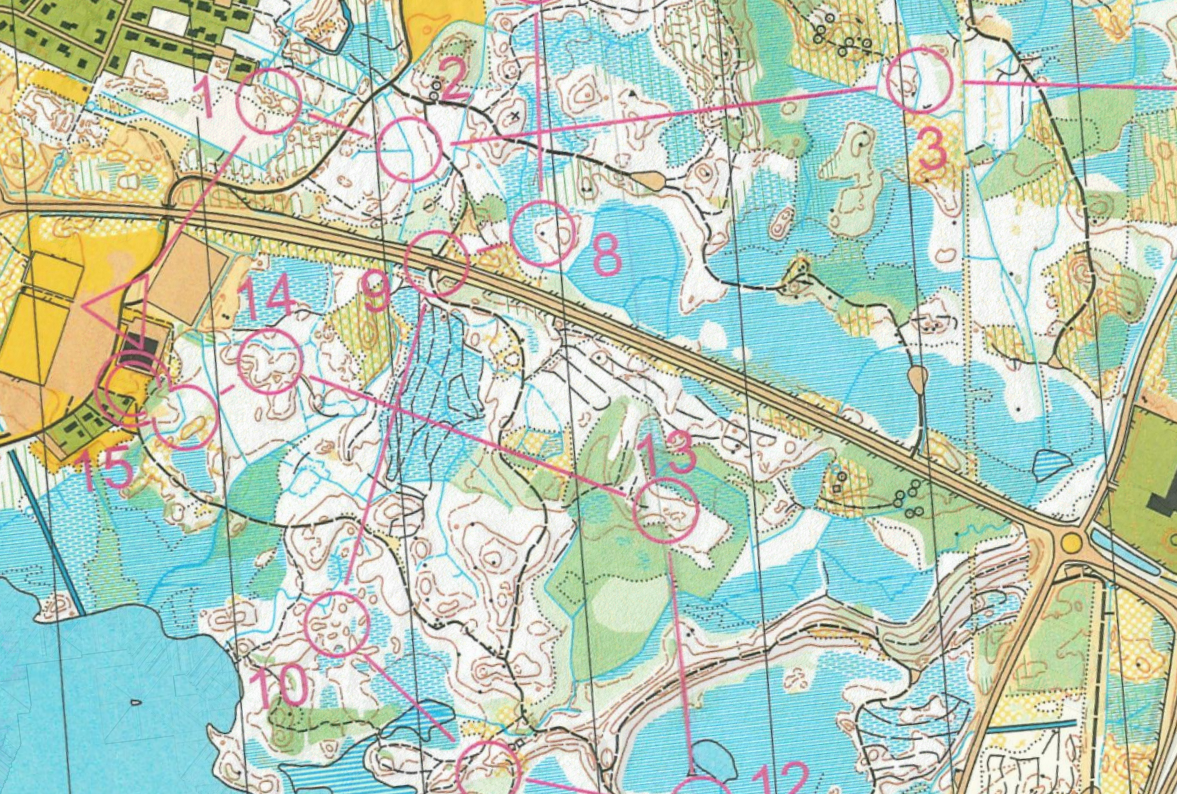
During the fieldwork I was being extra careful to try and stick to the spec. The forest was quite typical - mostly used for commercial timber but broken up into fairly small sections with different ages of tree. I think the word is 'blandskog', which counterintuitively means 'mixed forest'. So, there were quite a lot of distinct vegetation boundaries, but they didn't always match up exactly with runnability, some places had more thinning and undergrowth, or small stands of dense young spruces in otherwise white forest.
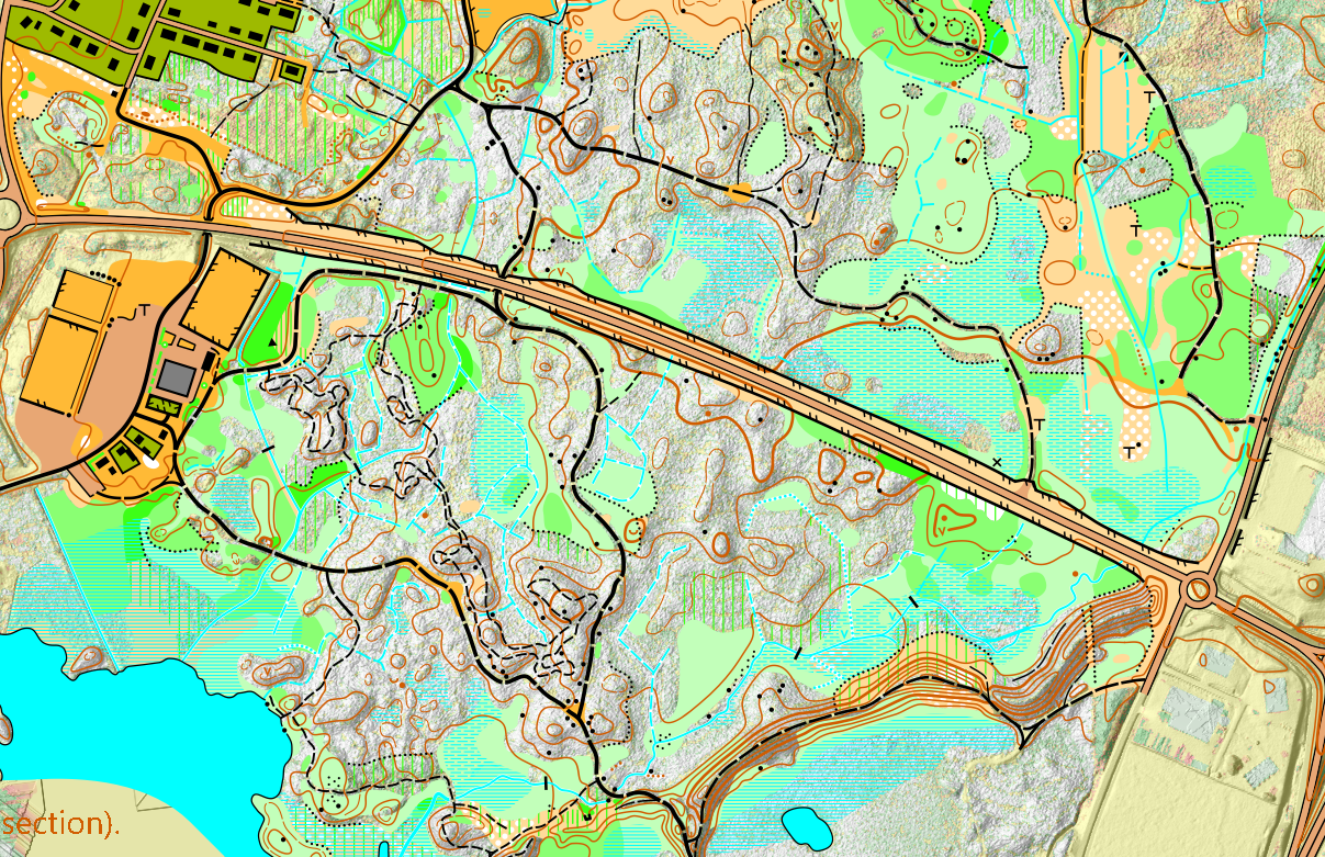
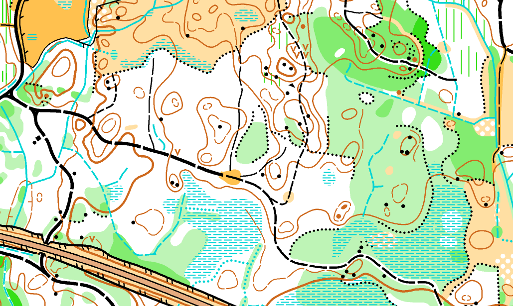
And then the final map...
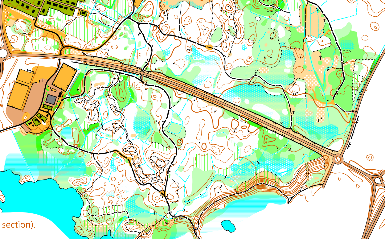
The new mountain biking path makes things look a little messy in that area, but I couldn't not put it on. There are still some tweaks Joel or I could make when finalising the map, like giving each stream/ditch a thin white outline when it is going through green. Overall though I think it is one of the most spec-compliant forest maps I've made. Lastly, I'd like to say another big thank you to Joel and Linnea for having me for 3 weeks and making it so enjoyable!
