Polmaise
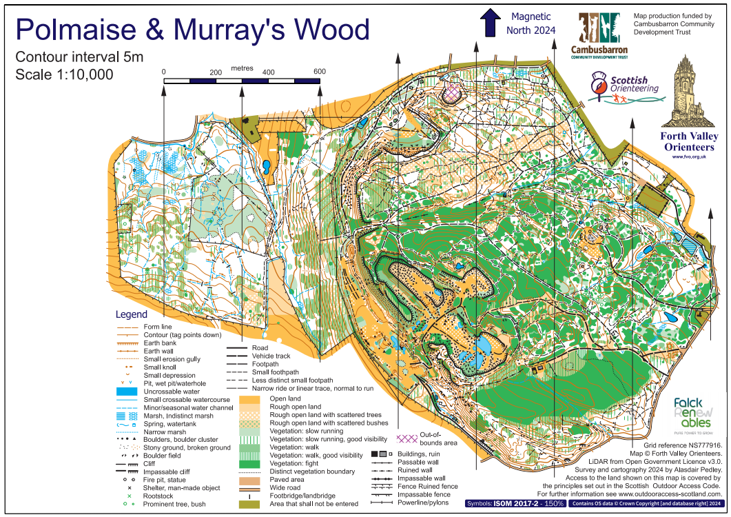
After so long working on sprint maps, I was very much looking forward to getting my teeth into a big forest project in August. Polmaise is a truly unique area close to Stirling which FVO frequently use. Having run there once or twice previously I knew it would be tricky and time-consuming to map, a real challenge to find the balance between pure accuracy and readability.
As usual, we start with LiDAR. Here's one section:
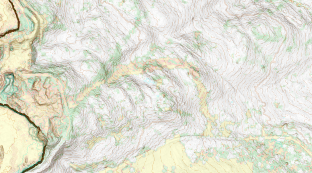
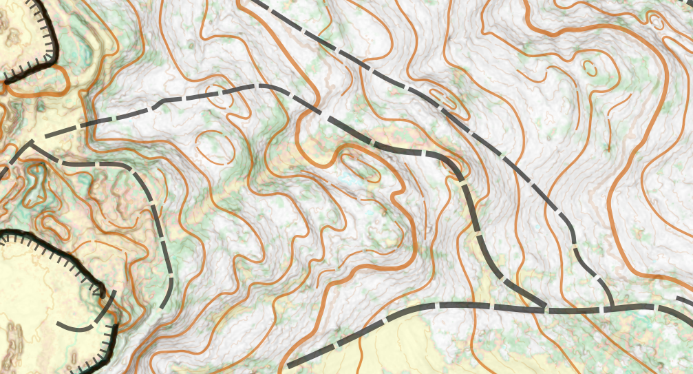
Once I have the LiDAR (and the OS map) from OCAD I go to OpenOrienteering Mapper to start on the drawing. The OS map is good for the boundary fences/walls and major roads/tracks, and it's worth drawing some of these before the contours if you can so that you can avoid drawing a contour directly underneath a track or fence. As you can see above, there are clearly some big crags in the west of this section (it's an old quarry) so I'd draw those first and then just feed the contours into each end of the crags. There are also some interesting contour shapes in the middle of the extract. I know some mappers would prefer to draw all their contours when they are there doing fieldwork, but I prefer to draw them in advance and then edit where needed on the ground. I always try to put some thought into where I'm drawing them though, rather than blindly tracing. You really want to try and capture the steeper slopes and the biggest shapes, and you have roughly a +-1m leeway to make this happen. If that's not possible with the contours, you bring in a form line.
There is an old map of Polmaise (here), which has been used fairly recently for events, but I really didn't find it much use. Because it's not LiDAR, the contours are a bit off, and then all the other features are warped slightly to fit with those contours (or perhaps the other way round, I'm not sure). Occasionally during fieldwork I would look at it to see which boulders they'd mapped, or where they'd mapped a boulder or some significant trees, I went looking specifically for them.
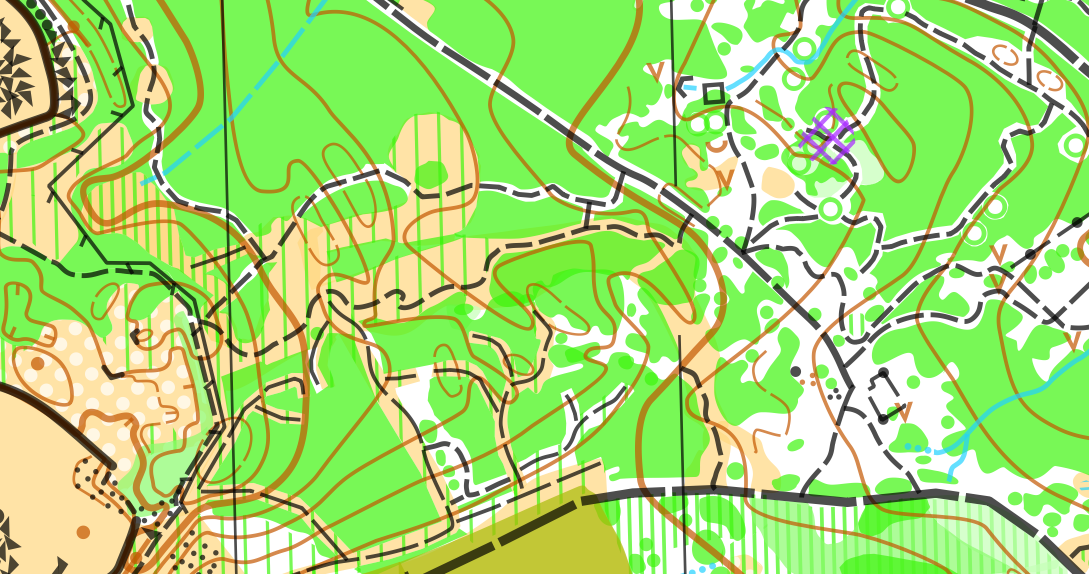
The fieldwork was challenging and very time consuming. I had estimated maybe 8-10 days on it and in the end it took 12. The toughest was all the rhododendron bushes, infiltrating them trying to see where you could get through and where you couldn't. So, in many ways it is a little like a sprint map, where the 'fight' is almost always physically impenetrable and if you could get through it was medium green. Because of the impenetrable nature of much of it, where there were some gaps I felt like it was important to map it all as accurately as I could, rather than generalise large chunks to e.g. medium green. I would generally try and draw all the small paths first, fitting them to the contours, which would then break the blocks of rhododendrons into more manageable sections. If the contours were quite vague all I really had was the GPS and my eyes. I don't use compass and pacing, like people would do in the old days, but sometimes I wonder if it might help in some situations.
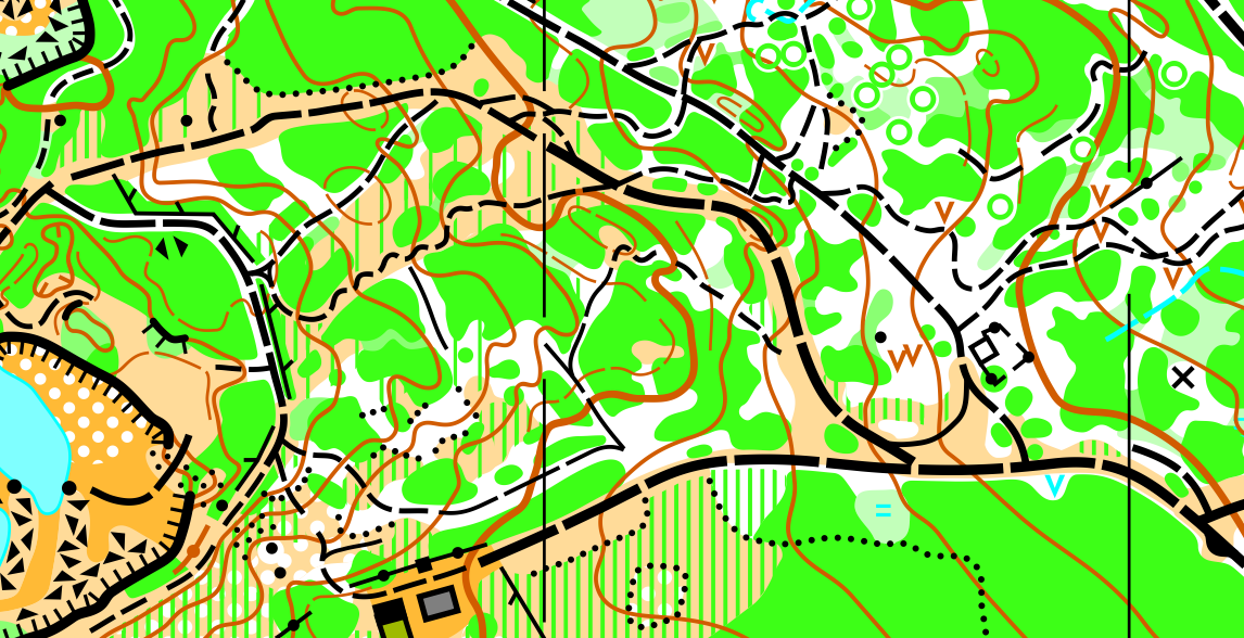
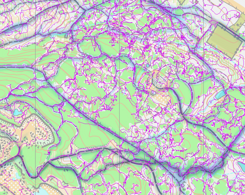
For double checking the paths, I got the Strava heatmap up in the background, which is obviously GPS based too, but at least is an average of many people's GPS. The lines are pretty wide and blurry but it was useful as a second check.
I'm going to finish by talking about a few cartography things.
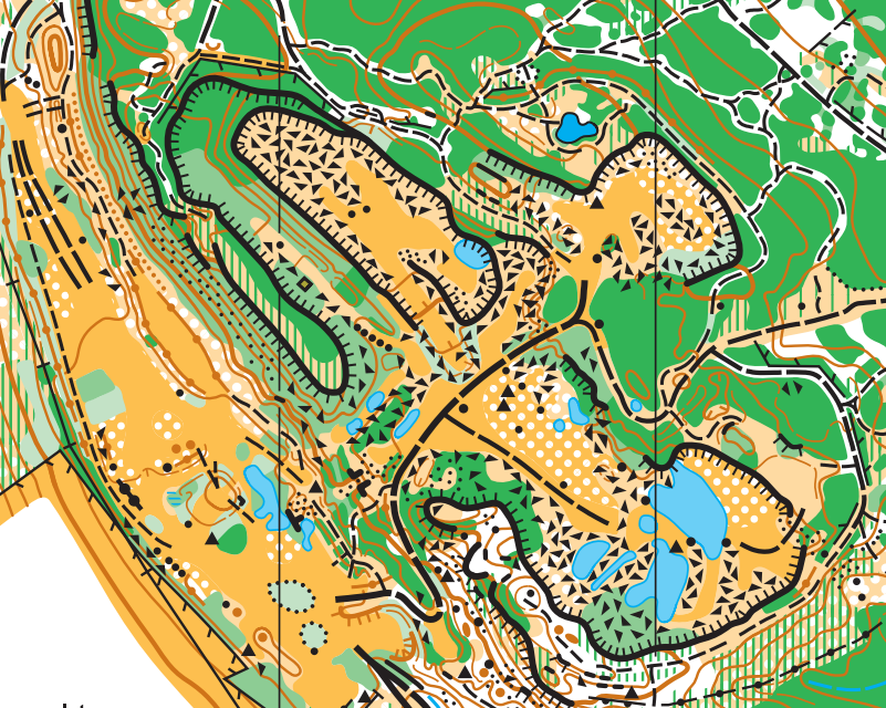
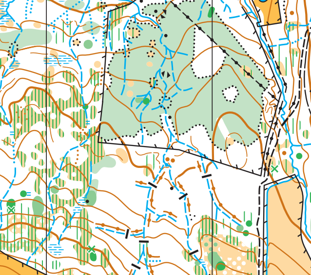
Looking at the extracts above, there are some good things and some areas I could improve, which I've realised since finishing. First the things I think are good:
- Boulder fields not interfering with any other black things (except north lines). I thought it was more important to keep the tags on the cliffs than to show that the boulder fields went right up to the base of them.
- The erosion gully and earthwalls in the north-west of the quarry extract, which I put some effort into.
- The ditches and earthwalls in the second extract - leaving a good gap between ditch and earthwall, getting the minimum length of earthwall in, and cutting the contours for them. Most of the bridges are land bridges, so I cut the ditches for them.
Things that could be improved:
- The edges of the scattered trees often cut through the white circles. I now know that it looks a lot neater when you tweak it so you only ever show whole circles.
- Some of the path junctions aren't as neat as they could be, in terms of positioning the dashes and the gaps of the paths.
- It's hard to see contours underneath fight in the quarry section, so perhaps they could be simplified a bit further to make it easier to get the big picture.
- The positioning of the gaps in the form lines. I'm not sure that I put any effort into these, but since then, from spending time with a mapper in Sweden (more on that soon!) I've come around to thinking it does looks a lot neater when you put the gaps on the straight sections and not on sharp corners.
- I'm sure some of the areas of vegetation are smaller than the minimum size, and the spec says you should exaggerate or leave off.
If you ran the event today, I hope you enjoyed it and appreciated the map!
